At the moment there are no threats to the United States with this system, but parts of the Lesser Antilles should be prepared for hurricane-force weather by Friday morning as the current forecast calls for this storm to evolve into Hurricane Bret by late Thursday.
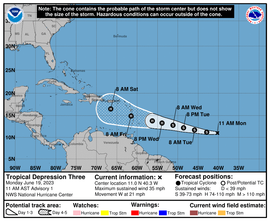
The current forecast cone, which only shows where the center of the tropical system is likely to be at a given point in time, has the storm becoming a tropical storm as early as later on today. Intensification is expected through the week, with the system nearing the Greater Antilles by Saturday morning.
Tropical Depression 3 formed in a part of the ocean we don’t normally see many systems spin up in during the month of June. Oftentimes this time of year this part of the ocean isn’t warm enough for robust tropical development, as its areas around the Gulf and off the eastern US where typically water temperatures are warm enough.
This year though, there is an abundance of warm ocean water in the Atlantic. The map below is a sea surface temperature anomaly map. The darker the red, the warmer the ocean temperatures are compared with what’s typical for today’s date. The darker the blue, the cooler the water temperatures are for this time of year.