The National Hurricane Center (NHC) began monitoring a tropical wave over western Africa on August 26. The tropical wave moved off the coast of the continent late on August 27. Throughout the next two days, showers and thunderstorms associated with the wave became better organized and gradually coalesced into a low-pressure area, as the system passed just south of and then through the Cape Verde Islands on August 29. Around 00:00 UTC on the following day, the system developed into a tropical depression just west of the Cape Verde Islands. Six hours later, the depression intensified into Tropical Storm Irma, based on scatterometer data and satellite estimates. With warm sea surface temperatures and low wind shear, strengthening was anticipated, with the only hindrance being slightly cooler waters and drier air.
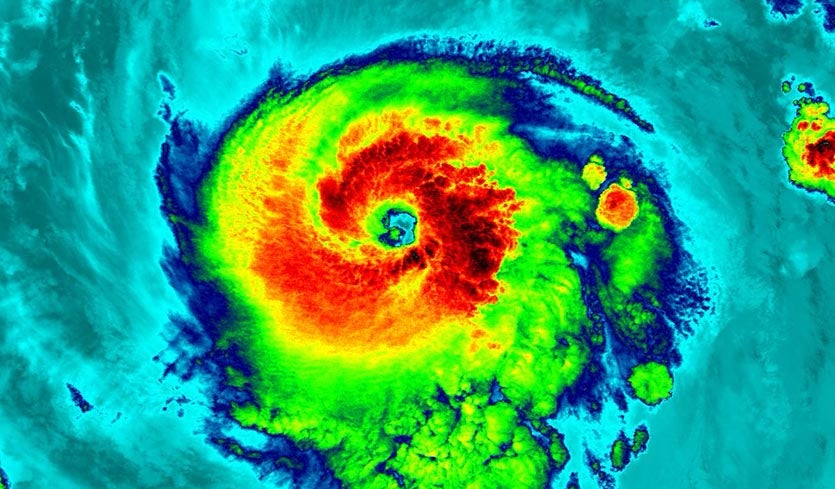
The nascent storm began developing upper-level poleward outflow, as an anticyclone became established over the system, with banding features becoming increasingly evident in satellite images. Early on August 31, shortly after the development of a central dense overcast (CDO) and an eye feature, Irma underwent rapid intensification, becoming a Category 2 hurricane at 18:00 UTC and then a Category 3 hurricane, becoming a major hurricane – around 00:00 UTC on September 1. Within a 48-hour period, the hurricane’s intensity had increased by 65 mph (105 km/h). On September 2, a ship passed 60 mi (97 km) to the west of the center of Irma, recording maximum winds of 45 mph (72 km/h), which indicated that the eye of Irma remained compact. A strong high pressure system to the north of Irma caused the storm to move west-southwestward between September 2 and September 4. The first aircraft reconnaissance mission departed from Barbados on the afternoon of September 3, discovering an eye 29 mi (47 km) in diameter and surface winds of 115 mph (185 km/h).
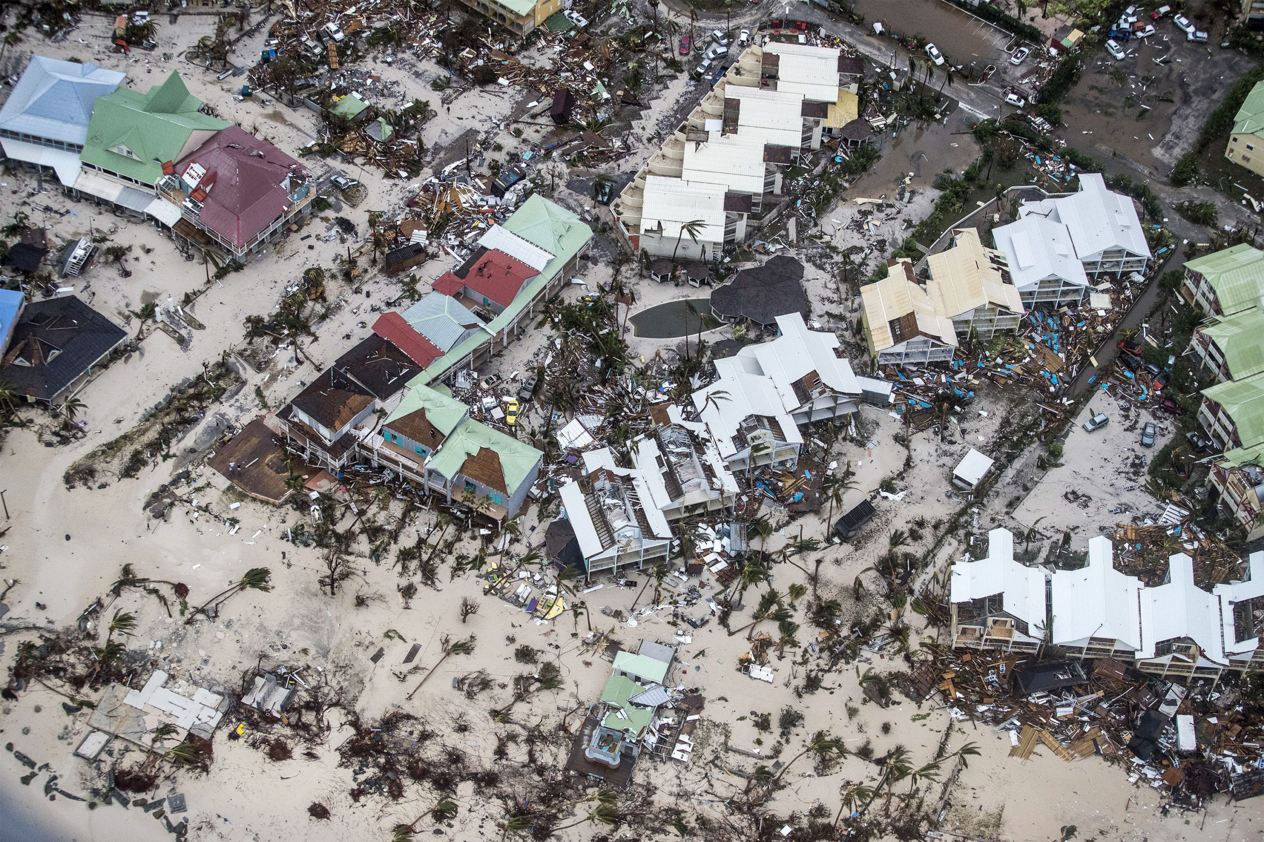
On September 4, after moving into more favorable conditions, Irma strengthened into a Category 4 hurricane. As it continued approaching the Leeward Islands, Irma underwent a second and more robust period of rapid intensification, becoming a Category 5 hurricane by 12:00 UTC on the following day, with winds of 175 mph (280 km/h). The extremely powerful hurricane continued to intensify, with maximum sustained winds peaking at 180 mph (285 km/h) near 18:00 UTC on September 5. Irma acquired annular characteristics around this time, with the storm exhibiting a large, symmetric CDO and an impressive satellite appearance. Irma continued to intensify while approaching the northern Leeward Islands. Almost eight hours later, around 05:45 UTC on September 6, Irma made landfall along the northern coast of Barbuda at peak intensity, with the storm’s central minimum pressure having bottomed out at 914 mbar (27.0 inHg) – this was the lowest in the Atlantic since Dean in 2007; the storm also made landfall with maximum sustained winds of 180 mph (285 km/h). Irma continued to maintain its peak intensity until 12:00 UTC on September 6 and made additional successive landfalls on that same day, at 11:15 UTC on Sint Maarten, and at 16:30 UTC on Virgin Gorda, in the British Virgin Islands, though the storm’s central pressure had risen slightly prior to its third landfall.
As the hurricane moved away from the Virgin Islands late on September 6, observations from reconnaissance flights, as well as Doppler radar in San Juan, Puerto Rico, indicated an elliptical eye and double eyewalls. Late on September 6, the cyclone passed about 60 mi (97 km) north of Puerto Rico. Moving west-northwestward, Irma closely paralleled the north coast of Hispaniola throughout the day on September 7. After beginning an eyewall replacement cycle, Irma weakened to a Category 4 hurricane as it passed south of the Turks and Caicos Islands early on September 8. This subsequently ended the 60-hour contiguous period of Irma maintaining Category 5 intensity, the second-longest any Atlantic storm had maintained winds above 156 mph (251 km/h) – behind only the 1932 Cuba hurricane. At 05:00 UTC on September 8, Irma made landfall on the island of Little Inagua in the Bahamas with sustained winds of 155 mph (250 km/h). The hurricane then began tracking more to the west due to the intensification of a subtropical ridge to its north. Once the eyewall replacement cycle was complete, Irma began to re-intensify, and it re-attained Category 5 intensity at 18:00 UTC that day east of Cuba as deep convection became more pronounced and organized. The hurricane then made landfall in Cayo Romano, Cuba, at 03:00 UTC on September 9, with winds of 165 mph (270 km/h). This made Irma only the second Category 5 hurricane to strike Cuba in recorded history, after the 1924 Cuba hurricane. As the eye of Irma moved along the northern coast of Cuba, gradual weakening ensued due to land interaction, with the eye becoming cloud-filled and the intensity falling to a high-end Category 2 storm later on September 9.
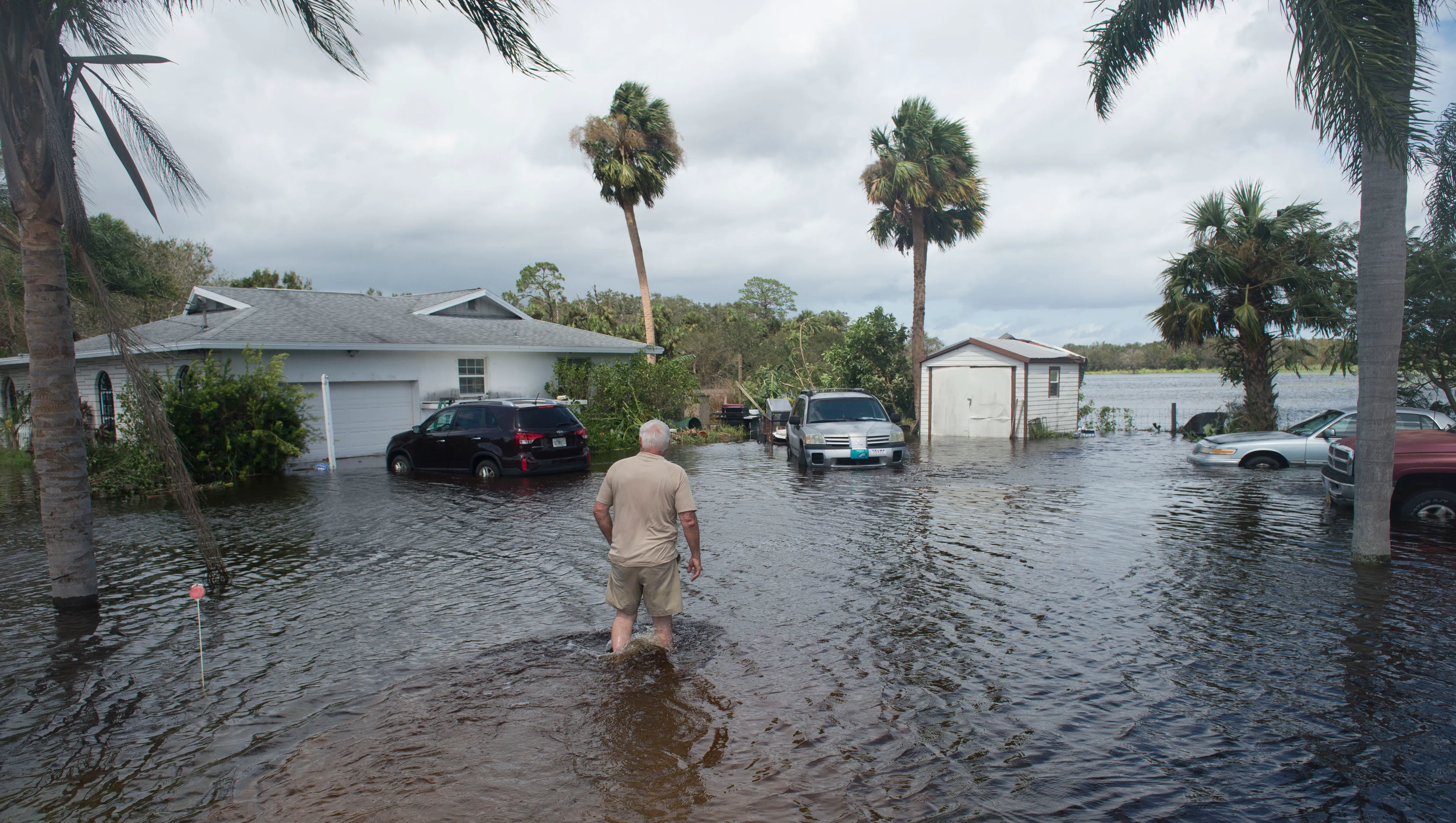
After slowing down late on September 9, the hurricane turned northwestward towards Florida around the southwestern edge of the subtropical high to its northeast and a low-pressure system that was located over the continental United States. Moving over the warm waters of the Straits of Florida, Irma quickly restrengthened to a Category 4 hurricane at 06:00 UTC on September 10, as deep convection improved and the eye became better defined. In addition, Irma’s wind field continued to increase in size, with hurricane-force winds spanning out a region of 80 mi (130 km) and gale-force winds spanning 220 mi (350 km) in diameter. The cyclone made landfall in Cudjoe Key, Florida, at 13:00 UTC on September 10, at Category 4 intensity, with winds of 130 mph (215 km/h). Increasing wind shear and land interaction caused the satellite appearance of the storm to become ragged later that day, and Irma weakened to Category 3 intensity before making its seventh and final landfall at 19:30 UTC, in Marco Island, Florida, with sustained winds of 115 mph (185 km/h). Once Irma had moved inland, it began to accelerate to the north-northwest, while rapid weakening began to occur due to the increasing wind shear, land interaction, and dry air, with the storm falling below Category 3 intensity hours after landfall. Passing east of Tampa as a weakening Category 1 hurricane around 06:00 UTC on September 11, Irma continued to weaken as most of the deep convection became more spread out towards the northern semi-circle of the circulation – though it retained a large wind field, with most of Florida experiencing gale-force winds. The system finally weakened to a tropical storm around 12:00 UTC that day as it entered southern Georgia, while acquiring some extratropical characteristics. At 06:00 UTC on September 12, Irma degenerated to a remnant low just as it entered Alabama, as most of the deep convection had diminished. The remnants persisted for another day or so before dissipating over Missouri on September 13.