NWS National Hurricane Center Miami FL
800 PM EDT Wed Jun 1 2022

For the North Atlantic...Caribbean Sea and the Gulf of Mexico:

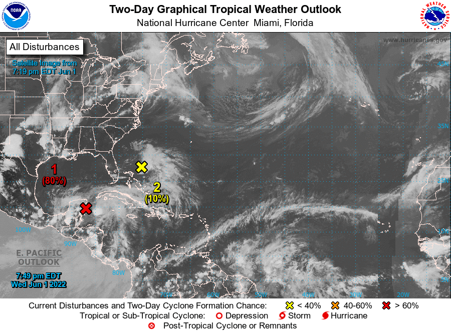
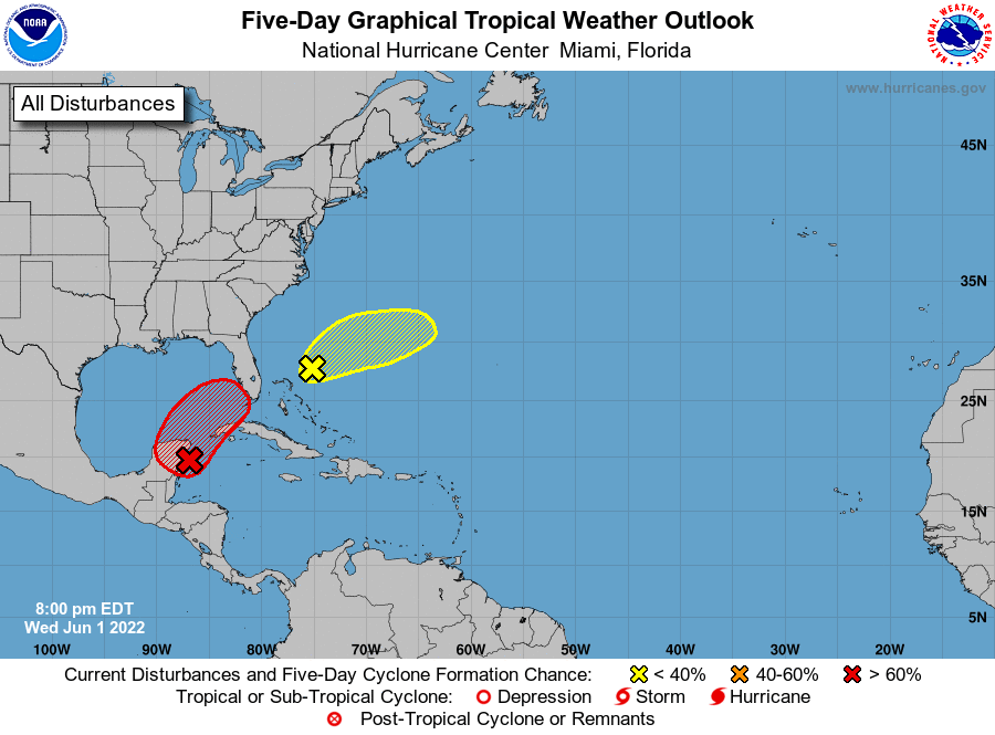
1. Near the Yucatan Peninsula and Southeastern Gulf of Mexico:
A broad area of low pressure located near the east coast of the
Yucatan Peninsula is producing a large area of disorganized showers
and thunderstorms over the northwestern Caribbean Sea and Yucatan
Peninsula.  Despite strong upper-level winds, gradual development is
forecast and this system is likely to become a tropical depression
while it moves slowly northeastward over the northwestern Caribbean
Sea and southeastern Gulf of Mexico during the next day or two.
Regardless of development, locally heavy rainfall is likely across
portions of the Yucatan Peninsula during the next day or so,
spreading across western Cuba, South Florida, and the Florida Keys
on Friday and Saturday. Interests in the Yucatan Peninsula, western
Cuba, the Florida Keys, and the Florida Peninsula should monitor the
progress of this system.
* Formation chance through 48 hours...high...80 percent.
* Formation chance through 5 days...high...80 percent.

2. Southwestern Atlantic northeast of the Bahamas:
A weak surface trough located about 150 miles northeast of the
northwest Bahamas is producing disorganized showers and a few
thunderstorms. While surface pressures have lowered somewhat over
the past day or so, environmental conditions appear only marginally
favorable, and significant development of this system appears
unlikely as it moves generally east-northeastward over the next
several days away from the southeastern United States.
* Formation chance through 48 hours...low...10 percent.
* Formation chance through 5 days...low...10 percent.