With Tropical Storm Danny out of the picture, our attention shifts to the open Atlantic where two tropical waves are being monitored for possible development down the road.
The leading tropical wave is one we’ve been tracking for over a week now, but a new disturbance directly behind the first also bears watching in the coming days.
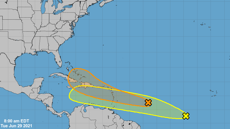
The environment around both disturbances is pretty unfavorable for the time being; dry air (Saharan dust) and slightly cooler water temperatures are working to hinder development chances in the short term.
However, this could change later this week as the two tropical waves push west toward the Caribbean where water temperatures are warmer and the Saharan dust not nearly as dense.
The National Hurricane Center gives disturbance #1 a 40% chance to develop in the next 5 days and disturbance #2 a 20% chance.
The latest model plots for disturbance #1 bring the center of low pressure toward the Lesser Antilles Wednesday, but the models diverge quite a bit into the weekend. This kind of model spread is pretty normal to see for tropical disturbances that aren’t very well developed, and models aren’t that reliable until there’s something more organized to track.
We’ll have to wait until later today for the spaghetti plots to come out for disturbance #2.
It’s somewhat unusual for tropical systems to originate this far out in the Atlantic so early in the hurricane season because typically this part of the ocean isn’t quite ripe enough for development.
It’s too early to know if either of these disturbances could have any impact on the U.S. mainland.
Are you prepared for hurricane season? Now is the time to brush up on your tropical weather knowledge.