Over the Atlantic basin on this Wednesday night, a small area of low pressure is located a couple of hundred miles east of Barbados. However, increasing upper-level winds are likely to prevent further development of this system while it moves west-northwestward at about 10 mph. It has a low (10 percent) chance of formation during the next 48 hours and five days. This disturbance could produce increased shower activity and some gusty winds when it moves across the Lesser Antilles on Friday.
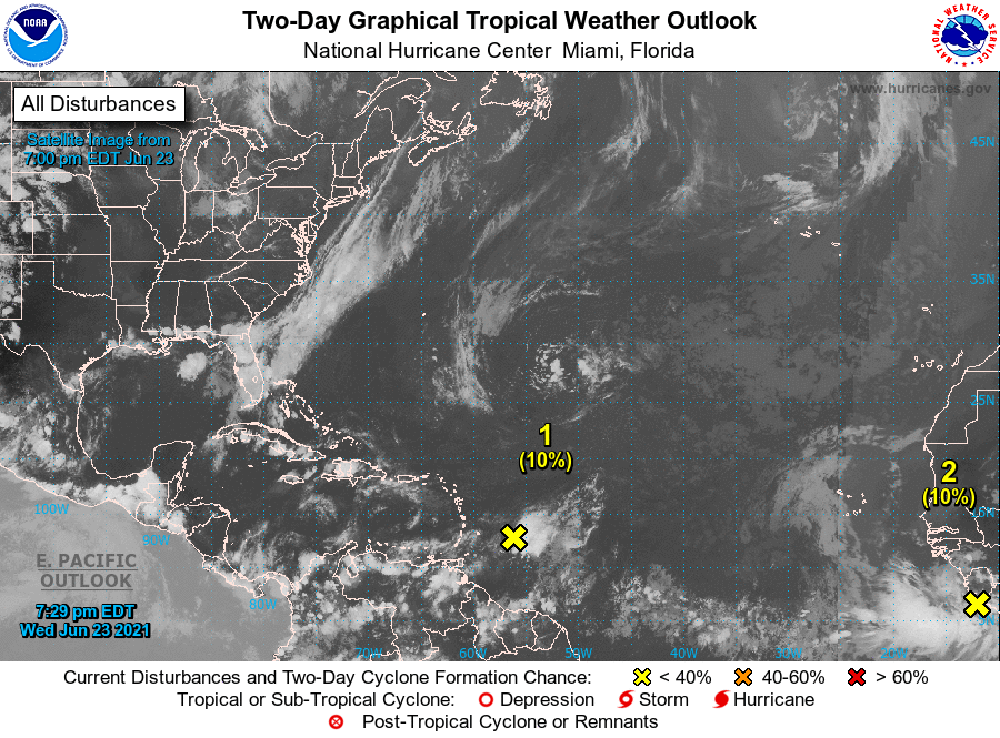
Elsewhere, a strong tropical wave is expected to emerge off the coast of Africa overnight and on Thursday. Some development of this system is possible late this week and into early next week while it moves westward to west-northwestward at about 15 mph across the tropical eastern and central Atlantic Ocean, where ocean temperatures are only marginally conducive for tropical cyclone formation. It has a low (10 percent) chance of formation during the next 48 hours and a low (30 percent) chance during the next five days. www.hurricanes.gov