…CENTER OF CLAUDETTE NOW MOVING OVER WESTERN ALABAMA……HEAVY RAINS AND GUSTY WINDS CONTINUE ACROSS PORTIONS OF THE SOUTHEAST U.S…A Tropical Storm Watch is in effect from Cape Fear to Duck, North Carolina, including Pamlico and Albemarle Sounds. Tropical storm conditions are possible in the watch area Sunday night and Monday. Interests elsewhere across the southeast U.S. should monitor the progress of this system.
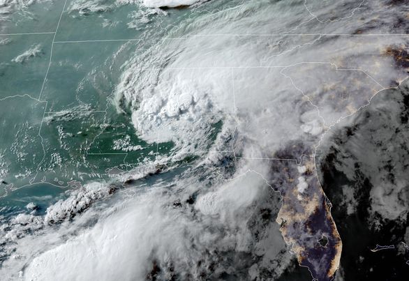
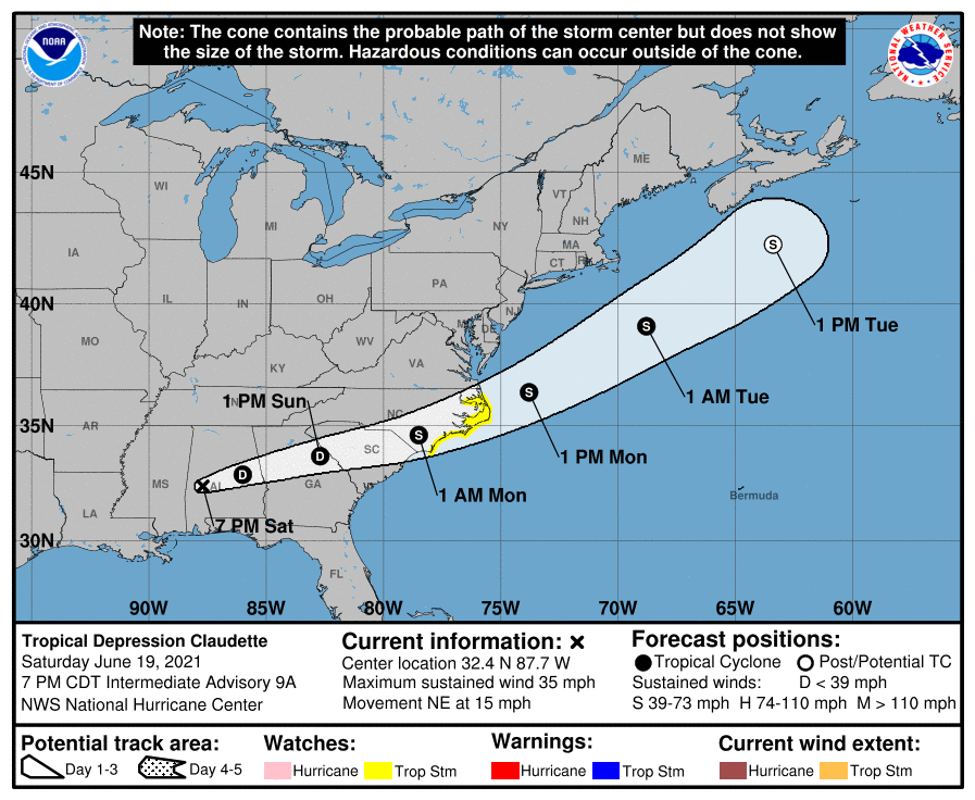
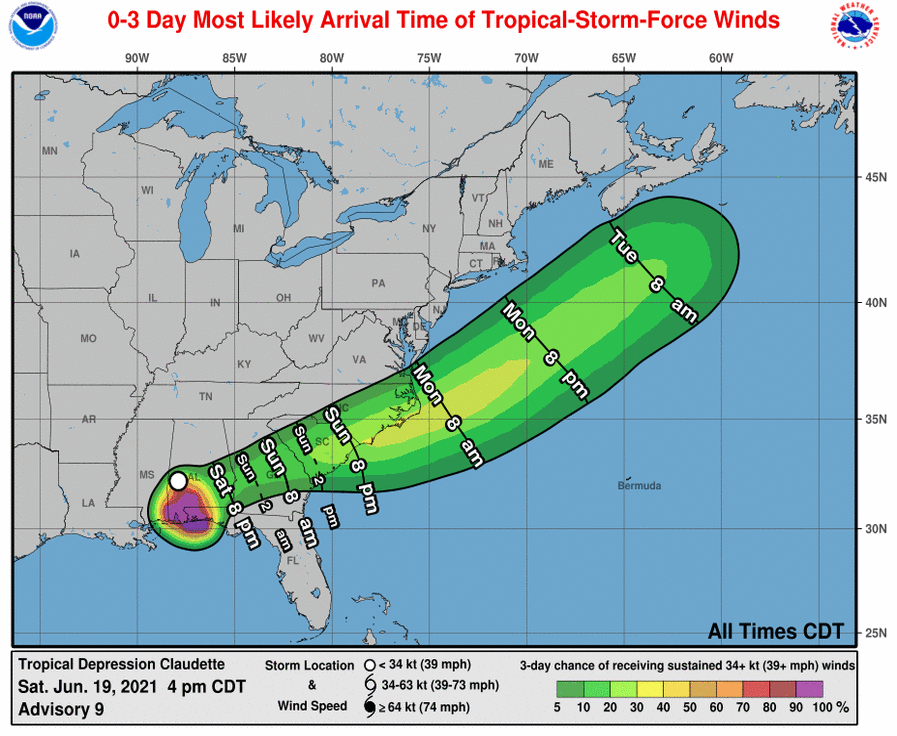
For storm information specific to your area, including possible inland watches and warnings, please monitor products issued by your local National Weather Service forecast office www.weather.govAt 7 p.m. CDT, the center of now Tropical Depression Claudette was located inland over western Alabama about 75 miles (120 km) west of Montgomery. It’s moving toward the northeast near 15 mph (24 km/h). A turn toward the east-northeast is expected tonight and Sunday. On the forecast track, the system should move farther inland across portions of the southeast U.S. through Sunday night, and over the western Atlantic Ocean on Monday.
Maximum sustained winds are near 35 mph (55 km/h) with higher gusts. These winds are occurring mainly over the water well to the south of the center. Claudette is expected to weaken a little tonight, However, it is forecast to become a tropical storm again when it moves across the Carolinas Sunday night or early Monday.
Claudette is expected to produce additional rainfall totals of 3 to 6 inches, with isolated maximum amounts of 8 inches, across eastern Alabama, northern Georgia, the Florida Panhandle, and South and North Carolina. Flash, urban and small stream flooding impacts, as well as new and renewed minor to isolated moderate river flooding, are likely across these areas.
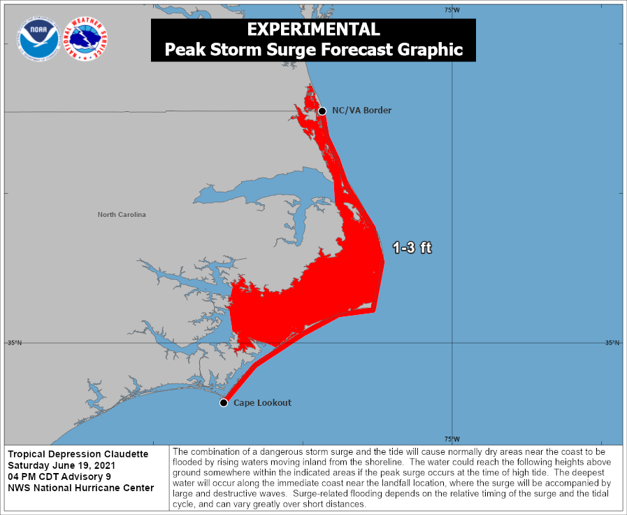
The combination of storm surge and the tide will cause normally dry areas near the coast to be flooded by rising waters moving inland from the shoreline. The water could reach the following heights above ground somewhere in the indicated areas if the peak surge occurs at the time of high tide…- Cape Lookout, NC to NC/VA Border…1-3 ftA few tornadoes are possible this evening and tonight across southeast Alabama, the western Florida Panhandle, and southwest Georgia.
The next complete advisory will be issued by NHC at 10 p.m. CDT – www.hurricanes.gov