Specially equipped NOAA aircraft play an integral role in hurricane forecasting. Data collected during hurricanes by these highflying meteorological stations and from a variety of other sources are fed into numerical computer models to help forecasters predict how intense a hurricane will be, and when and where it will make landfall. These computer models fulfill two important purposes: to help forecasters make accurate predictions during a hurricane and to help hurricane researchers achieve a better understanding of storm processes, and improve forecast models.
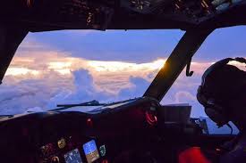
P-3 Aircraft: Into the Storm Slicing through the eyewall of a hurricane, buffeted by howling winds, blinding rain and violent updrafts and downdrafts before entering the relative calm of the storm’s eye, NOAA’s two Lockheed WP-3D Orion turboprop aircraft probe every wind and pressure change, repeating the grueling experience again and again during the course of a ten-hour mission.
Scientists aboard the P-3 deploy probes, called dropwindsondes, as the aircraft flies through the hurricane. These instruments continuously transmit measurements of pressure, humidity, temperature, and wind direction and speed as they fall toward the sea, providing a detailed look at the structure of the storm and its intensity.
Storm surge forecasting received a boost with the addition of Stepped Frequency Microwave Radiometers to NOAA’s P-3s. SFMRs measure over-ocean wind speed and rain rate in hurricanes and tropical storms, key indicators of potentially deadly storm surges. Surges are a major cause of hurricane-related deaths.
NOAA P-3s fly into hurricanes at low altitudes (1,500-10,000 ft.) to collect research-mission data critical for computer models that predict hurricane intensity and landfall. In addition, NOAA P-3s and U.S. Air Force Reserve WC-130Js conduct hurricane reconnaissance missions, primarily to locate the center of the storm and measure central pressure and surface winds around the eye. Information from both research and reconnaissance flights directly contribute to the safety of people on the vulnerable Atlantic and Gulf coasts.

In addition to flying hurricane research and reconnaissance missions, NOAA P-3s support a wide variety of national and international meteorological and oceanographic research programs, including weather satellite data verification missions, air quality studies, and tornado research.
NOAA’S HURRICANE HUNTERS
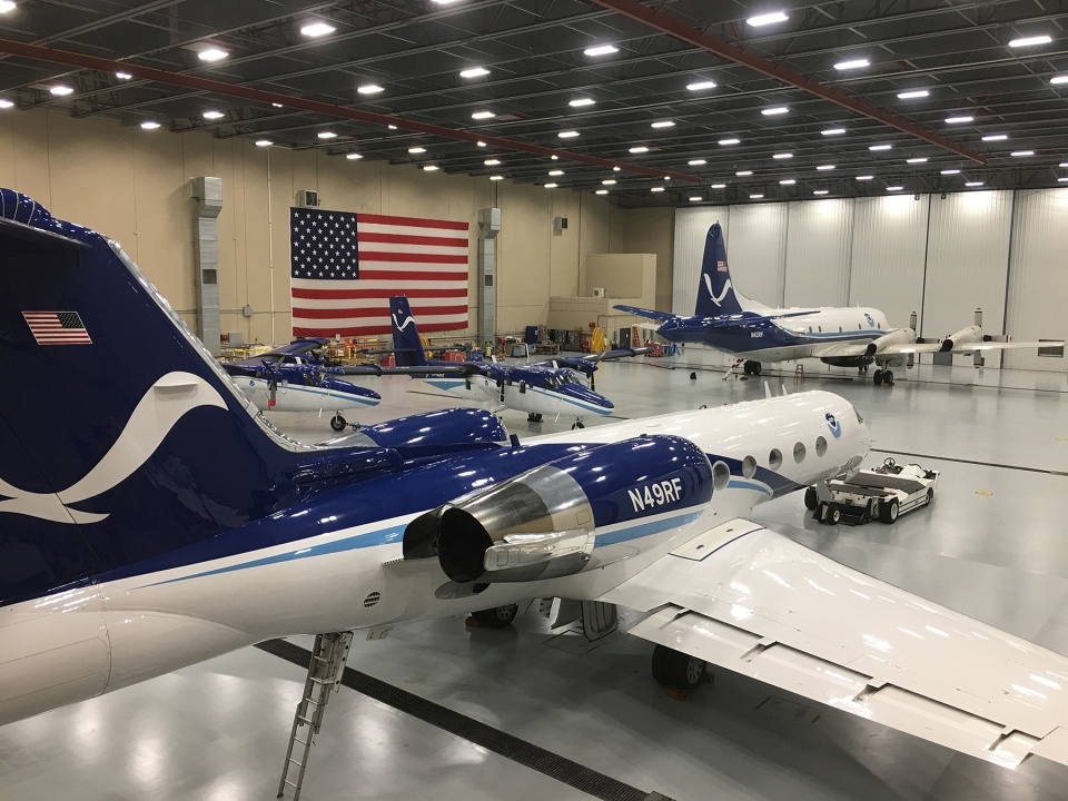
Lockheed WP-3D Orion NATIONAL OCEANIC AND ATMOSPHERIC ADMINISTRATION · UNITED STATES DEPARTMENT OF COMMERCE Updated May 2018 fact sheet | NOAA.gov G-IV Jet: Seeking the Storm’s Path NOAA’s Gulfstream IV-SP jet, which can fly high, fast and far with a range of 4,000 nautical miles and a cruising altitude of 45,000 ft., paints a detailed picture of weather systems in the upper atmosphere surrounding developing hurricanes. The GIV’s data also supplement the critical low altitude research data that are collected by NOAA’s P-3s.
Since the beginning of the 1997 hurricane season, the G-IV has flown missions around every Atlantic-based hurricane that has posed a potential threat to the United States. The jet’s mission covers thousands of square miles surrounding the hurricane, gathering with dropwindsondes vital high-altitude data needed for improved numerical forecast models. The G-IV maps the steering currents that influence the movement of hurricanes.

Data from dropwindsondes are relayed to the aircraft for transmission by satellite to the National Hurricane Center in Miami and the National Centers for Environmental Prediction in Maryland. There, the data are available for many numerical forecast models, providing important information about regions – mostly over oceans – in which there are no other sources of weather data.
Since 1997, when NOAA obtained the aircraft, data collected by the G-IV have enabled numerical guidance computer models to improve hurricane landfall and track forecasts by approximately 20 percent. The G-IV also has a tail Doppler radar system that enables the aircraft to acquire three-dimensional hurricane core wind data.
After hurricane season, NOAA has used the G-IV to help monitor and study atmospheric rivers and improve winter storm forecasts. The G-IV has also been used to study clear air turbulence – a condition that threatens the safety of air traffic over the Pacific Ocean, helping scientists increase their ability to understand and predict this phenomenon.
NOAA Aircraft Operations Center The P-3s and G-IV are based at the NOAA Aircraft Operations Center (AOC) at Lakeland Linder Regional Airport in Lakeland, Fla. AOC is part of the NOAA Office of Marine and Aviation Operations, which includes civilians as well as officers of the NOAA Corps, one of the nation’s seven uniformed services. NOAA Corps pilots and civilian flight engineers, meteorologists and electronic engineers are highly trained to operate in the kind of adverse weather conditions that keep other aircraft on the ground. Much of the scientific instrumentation flown aboard NOAA aircraft is designed, built, assembled, and calibrated by AOC engineers. During non-hurricane season months, the P-3s and G-IV are tailored for use in other severe weather and atmospheric research programs.
NOAA’s Air Operations Center at Lakeland Linder International Airport, home of the Hurricane Hunters, is getting two new aircraft: a modified Gulfstream G550 for use in storm forecasting and atmospheric research, and a Beechcraft King Air 350 CER turboprop for use in flood and water supply forecasts.
The U.S. National Oceanic and Atmospheric Administration (NOAA) awarded contracts for the purchase of two new aircraft on Monday. One will be a modified Gulfstream G550, which NOAA says will be used for missions including hurricane and tropical storm forecasts and atmospheric research. The second addition will be a Beechcraft King Air 350 CER turboprop. According to NOAA, the King Air will be outfitted with remote sensing equipment to gather data used in flood, river level and water supply forecasts. It will also be utilized in coastal mapping and aerial damage survey missions.
“These American-made aircraft will greatly enhance NOAA’s ability to collect data that are vital to forecasters, researchers, and emergency managers,” said acting NOAA administrator Neil Jacobs. “Observations from the high-altitude Gulfstream jet will greatly enhance NOAA’s predictive capabilities for hurricane track and intensification, while the King Air turboprop will provide essential data for many missions, including planning and recovery efforts for coastal and inland flooding.”

Delivery of the $40.7 million G550 is expected in 2022. The King Air 350 CER contract came in at $11.8 million with the aircraft scheduled to enter service in spring 2021. Both aircraft will be based at the NOAA Aircraft Operations Center in Lakeland, Florida, from which the agency currently operates a fleet of nine aircraft modified for environmental data-gathering.